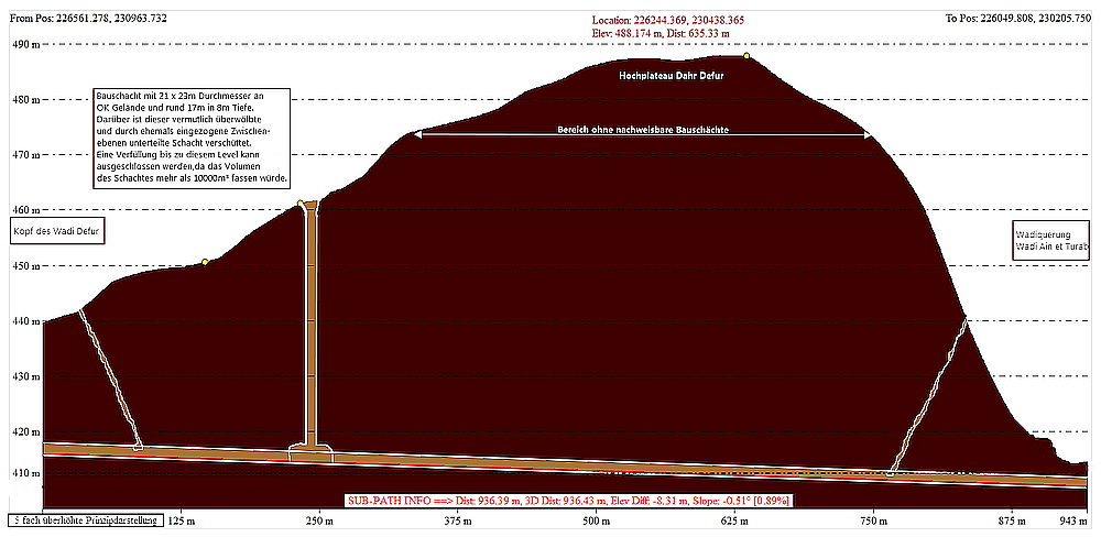
with a diameter of approximately 21m, it has the largest construction shaft of the entire aqueduct route.
Located between Wadi Defur and Wadi Ain et Turab, this section of the tunnel runs under the
The Dhar Defur plateau has a maximum of 488m asl in this area. The maximum coverage of the tunnel was over 77m.
Please take further information from the following sketch:

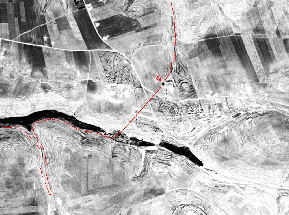
Particularly interesting is the largest construction shaft of the entire aqueduct route, found by me in November 2009.
With a diameter of OK terrain the construction shaft width of 21 x 23 m (height 462m asl) is minimize to about 8m depth to about 17m of diameter. Here, the upcoming rock horizon is already visible. By permanently produced rubble and garbage of the population living nearby, the construction shaft is filled at this level. (ca.454m asl). Due to the enormous dimensions, however, it can be ruled out that the construction shaft is completely filled up to the aqueduct sole of the aqueduct.
It is not very likely that this construction was needed for ventilation (this would have been a much smaller), but especially needed for lifting the excavated masses, since on at least 500m aqueduct length, no further construction shafts were tunneled because of the height and for efficiency reasons.
By consistently adhering to the given direction and inclination, the tunnel section in Wadi Ain et Turab could not arrive incorrectly, but also position errors of + - 10m in the axis, or height errors were tolerable and could be corrected due to the topography .
Further investigation could not be made without adequate security. From an engineering point of view following solution approaches result; which I would like discuss.

- The construction shaft was built on its entire depth of 47m under OK terrain with almost the same diameter. Here then on several levels, mutually offsets Wooden Plateaus were built to lift the overburden.
- The building shaft tapers at an unknown depth (only slightly below the current filling) to the "normal" size, so in any cases the removal of the overburden could have been optimized. However, this is only imaginable if the earthen ground had not been able to sustain at this unknown altitude. According to the pictures, the massive rock starts, but already above the still existing level in 8m depth under OK terrain.
- The original floor level of the construction shaft formed with two opposing construction shafts a "lowered" baseline, which had become necessary for better orientation over the long mountain / plateau crossing. (But would this form have been necessary for this?)
In addition, in each case, the question arises how the large open area of the construction shaft was secured or closed at the end of the construction project. Did the builder had a stone vault be moved in here, which still exists today !!! ?? and could so explain today's inner level of the construction Shaft ? For the construction shaft located at the upper end of the Wadi Defur, such a protection (due to surface water, moving soil and possible debris, which otherwise would have caused damage to the aqueduct), was definitely necessary. If the interested reader should be familiar with appropriate solutions from literature, ancient or even medieval mining, I would be happy to make contact with you. just send an email to mail@dekapolis-aquaedukt.de
The Qanat Fir'aun can be found beyond the mountain plateau in Wadi Ain et Turab.