MENU

Qanat Fir'aun / Decapolis Aqueduct

Der über 150 km lange, wiederentdeckte Dekapolis Aquädukt switch to german

Site-Übersicht

  • Qanat Fir'aun
  • the project
  • Surveying
  • important Places
  • Aqueductbridges
  • Substructions
  • other Tunnel Sections
  • previously unknown
  • Copyright

weiterempfehlen...

Copyright Jens Kleb ©2015-2023
All Rights Reserved

  • Wadi Zedi

  • Kharja

  • Hubras and Yubla

  • El Qabu

  • west of Dera'a, the Qanat Fir'aun already ran into a tunnel.

    According to Consul Wetzstein, a bridge crossed the Wadi ez Zedi on a single bold arch.
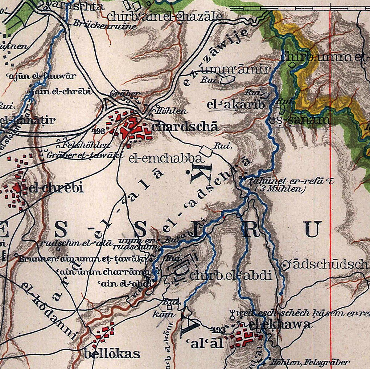
    The statement "45 minutes west of Deraa" can be explained as already stated in the section "North Dera'a", is not plausibly related to the region described here. All other information from Wetzstein correspond rather to the Jisr el Mesari; but from the lines of the aqueduct route, a bridge at Dera'as western suburbs is also suspected. Maybe two independent reports have been superimposed and were later written down by Wetzstein as one.
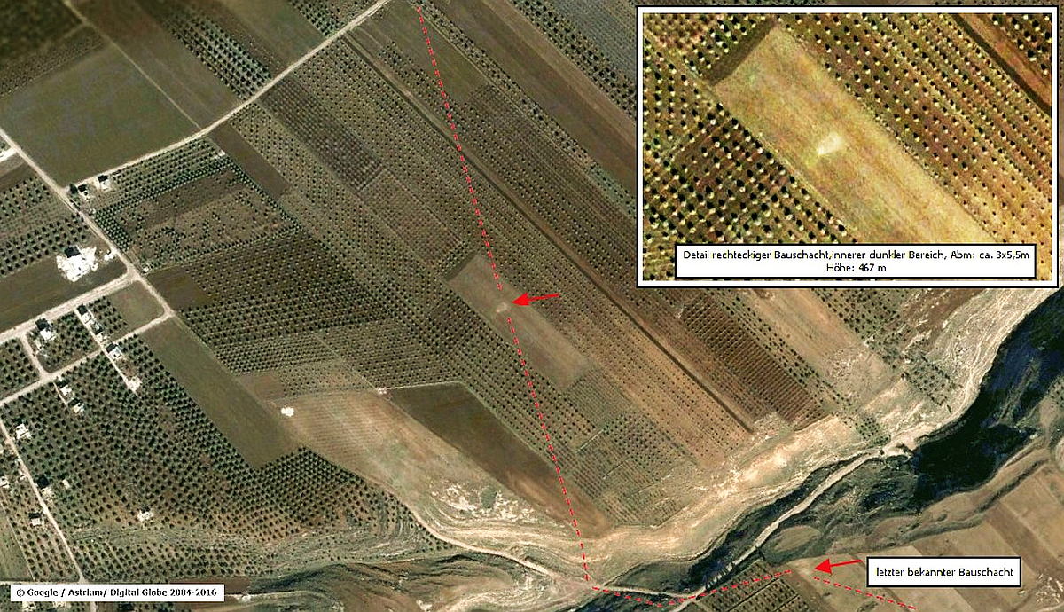
    After the rock-cut cisterns on the southern bank of the Wadi ez Zedi, the Qanat Fir'aun, also verifiable by building shafts (picture on the left), ran to a point on this side, which was the most plausible point of the bridge when considering the distance specification and satellite images.

    medan-ez-zedi-bridge-google2004

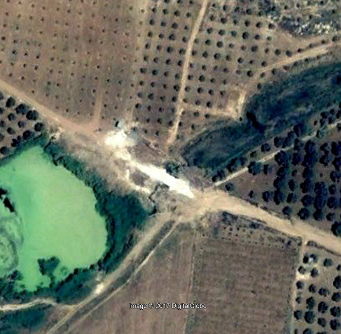
    The Google Earth image above from 2004, shows a new bridge and immediately old abutment remains to the southwest. At this point, the Qanat Fir'aun reached a height of ~ 466m asl and was thus able to switch to the northern side of the Wadi with its gentle rocky slopes.
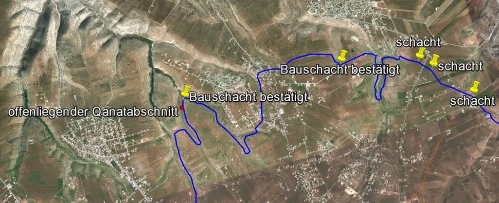
    Thereafter, the aqueduct ran as a near-ground channel with substructure, or just below the ground level as a bricked channel to the west (Abou el Qantara).

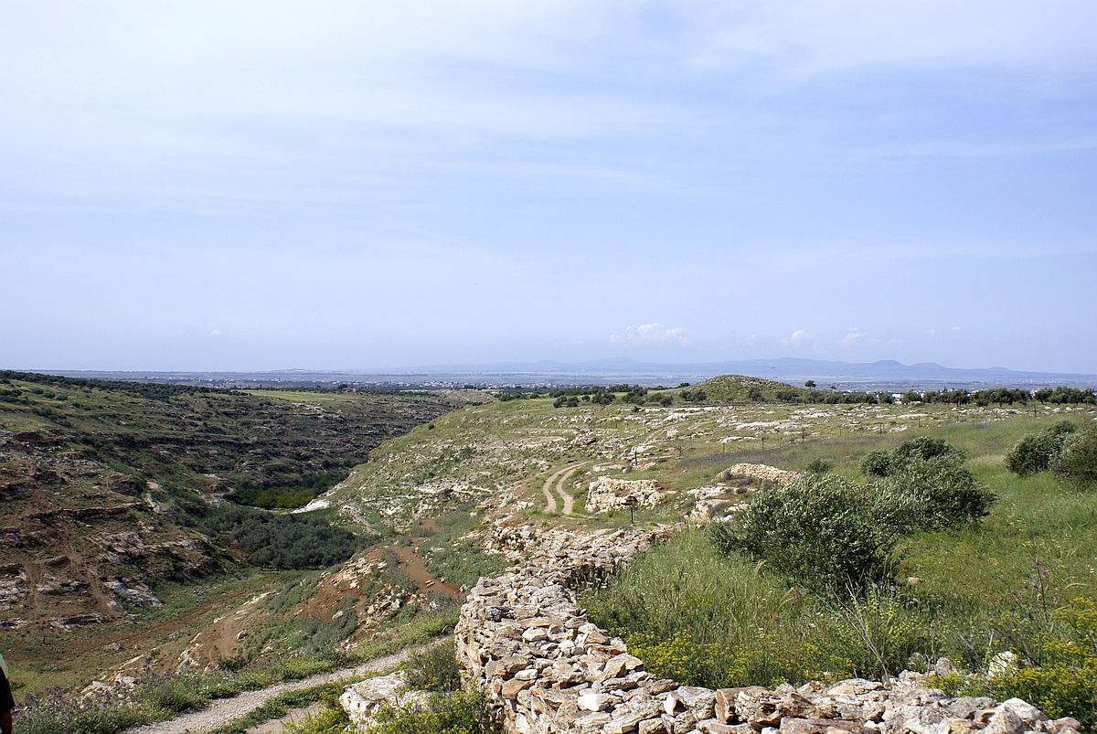
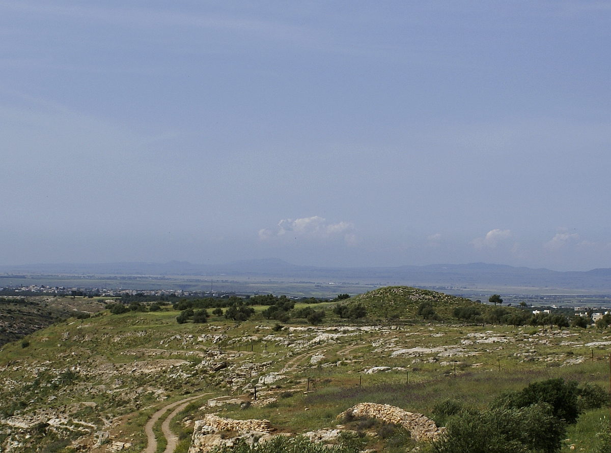
    Wadi ez Zedi nahe El Kokalije / Foto A. Abazid
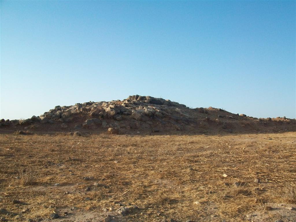
    El Kokalije Ruinenhügel

    There are only a few remains from Roman times, a small fort at "El kokalije" and fouling characteristics on some satellite images. Extensive new constructions and buildings, such as the construction of a large sewage treatment plant and the shift of modern, large sewage pipes, have led to a lack of evidence.

    The Qanat Fir'aun continues further to the west. Due to the high water demand, it is supplemented by the Bahret el Baddje,also known as the lake of Muzeirib. You get more information about that section by following this link here.

    Unfortunately, the current satellite images show hardly any details, like the one shown here on the left or above, but they still define the location of the buildings described.


    Quick Links

    • Qanat Fir'aun
    • the project
    • Surveying
    • important Places
    • Aqueductbridges
    • Substructions
    • other Tunnel Sections
    • previously unknown
    • Copyright

  • and its high plateau is characterized by deep construction shafts between Al Al and Wadi El Gazahleh.

    In the valley of Al Al including the water sources Ain Shiha and Ain Sukkar, the Qanat Fir'aun traverses the following wadi and then passes the Khirbet el Abdi, crossing the wadi of the same name. From there, the aqueduct runs up to 40 m deep, through the high plateau to Kharja, in order to leave it in a southwestern direction. Shortly before Barashta at Wadi Gazahleh, a 600m long section on the northwest slope of the Kharja plateau is relatively easy to recognize and visible.
    An overview provides an excerpt from the corresponding map of the DPV

    detail-abdi

    After digital calculation of the height data and the georeferencing of old s/ w satellite images, I was able to find construction shafts, which are hardly identifiable nowadays, and thus to find the course of the aqueduct along the Kharjaplateau. (see photo of the Univ. of Maryland on the left)

    The following Google Earth image shows the lowest marked construction shaft about 35 years later. In the meantime, however, there is no longer any indication for the construction shafts in the current satellite pictures.

    detail-schacht-und-wadi-abdi-bruecke

    The Qanat Fir'aun continues west; more information about the following section are available at: the Bridge in Wadi Queilbeh and the distribution channel to the City of Abila

    Here you can see the exact geolocation of this construction.


    Quick Links

    • Qanat Fir'aun
    • the project
    • Surveying
    • important Places
    • Aqueductbridges
    • Substructions
    • other Tunnel Sections
    • previously unknown
    • Copyright

  • While the course and involvement of the water sources of Hubras into the Qanat are very comprehensible,

    the aqueduct course along the following two side valleys is hardly to define since terracing measures were carried out which caused the lost of all construction shafts. Southwest of Yubla, the Qanat Fir'aun can be found relatively close to the surface again. It underleads lower side valleys, which drain off in the direction of Yarmuk and turns south again at the striking "Rujm Adaam".

    yubla

    The Rujm Adaam was incorrectly marked in some latest maps. In fact, it is a cairn almost west of Yubla which is 10-12 m high and 30 m in diameter.
    Located on a narrow mountain spur (finger) running directly to the north, it overlooks the entire plateau, which is only apparently lower due to the curvature of the earth, from which the Qanat Fir'aun aqueduct comes from. All Tullul and places of the plain, up to the Hermon Mountain, can be seen from this special place.

    The Qanat continues to one of the most remarkable sections, the large mountain tunnel through the ridge Dahr Defur with its huge construction shaft. Please Link to this section

    Here you can see the exact geolocation of this construction.


    Quick Links

    • Qanat Fir'aun
    • the project
    • Surveying
    • important Places
    • Aqueductbridges
    • Substructions
    • other Tunnel Sections
    • previously unknown
    • Copyright

  • is now called a mound of ruins just off the road east of Gadara.

    Here, the rectangular temple (sanctuary extra Muros) was surrounded by a wall and raised over several stone terraces one above the other. Today you can find except of mostly English detectorists, equipped with spade and pickaxe not even the terraces of the temple. Therefore, it can only be referred to G. Schumacher's Northern Ajlun, or future archaeological research for more information.
    At least from Ibdar and on the southern side of the old Roman ridge road, another water system ran to the direction of Gadara. The reports of the travelers and the maps of the "Deutscher Palästina Verein" show that the channel system described, logically did not always run parallel to the road. The mental association of the aqueducts in Syria, which became visible at the surface, and here in present Jordan gave the same name Qanat Fir'aun to both sections.
    This channelsystem was the third water supply system for Gadara, and will be explained here. In addition, the discovery of the second aqueduct bridge during my visit in Gadara in November 2009, proved this.
    Find out more about the further course of the Qanat Fir'aun and the already mentioned bridges in front of Gadara, here.

    Here you can see the exact geolocation of this place.


    Quick Links

    • Qanat Fir'aun
    • the project
    • Surveying
    • important Places
    • Aqueductbridges
    • Substructions
    • other Tunnel Sections
    • previously unknown
    • Copyright

  • Hubras and Yubla