MENU

Qanat Fir'aun / Decapolis Aqueduct

Der über 150 km lange, wiederentdeckte Dekapolis Aquädukt switch to german

Site-Übersicht

  • Qanat Fir'aun
  • the project
  • Surveying
  • important Places
  • Aqueductbridges
  • Substructions
  • other Tunnel Sections
  • previously unknown
  • Copyright

weiterempfehlen...

Copyright Jens Kleb ©2015-2023
All Rights Reserved

  • The Qanatir

  • North of W. Ezra

  • North of Dera'a

  • South of Muzeirib

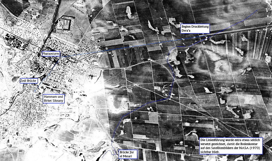
  • The first written testimonies about an aqueduct were provided by U.J. Seetzen, who was told on his travels by the “Kanatir”, and who also saw remains of them while crossing this landscape. Mainly, he meant the celestially remains of the aqueduct, which run through the landscape between Dilli and Deraa.

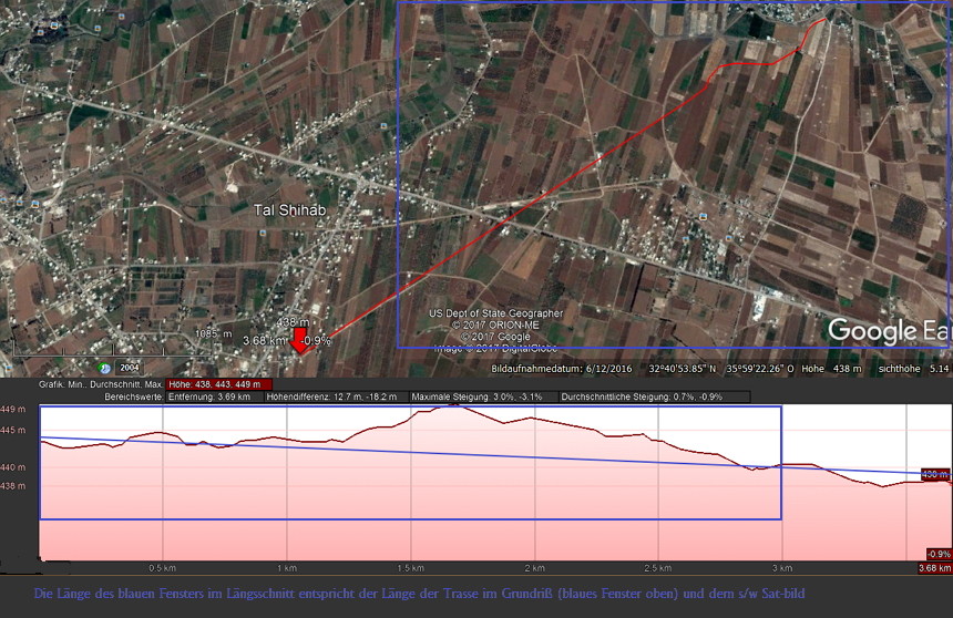
    With an average height over terrain of 2m, interrupted by up to 9m high bridges and arches, the aqueduct overcame the wadis on this path. The sub-sections of the aqueduct, which were constructed without arches for long distances, consisted of 2 shells of regular basalt masonry with an Opus Cementium infill, in which unhardened stones were laid. As a rule and for efficiency reasons, bows were erected from 2.5m clear height. Thus, not only material was saved, but also passages for livestock, transport and water could arise.

    substrukt

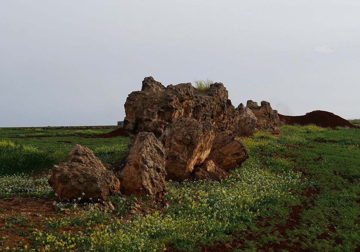
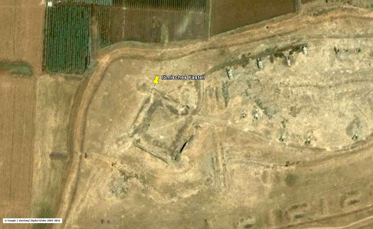
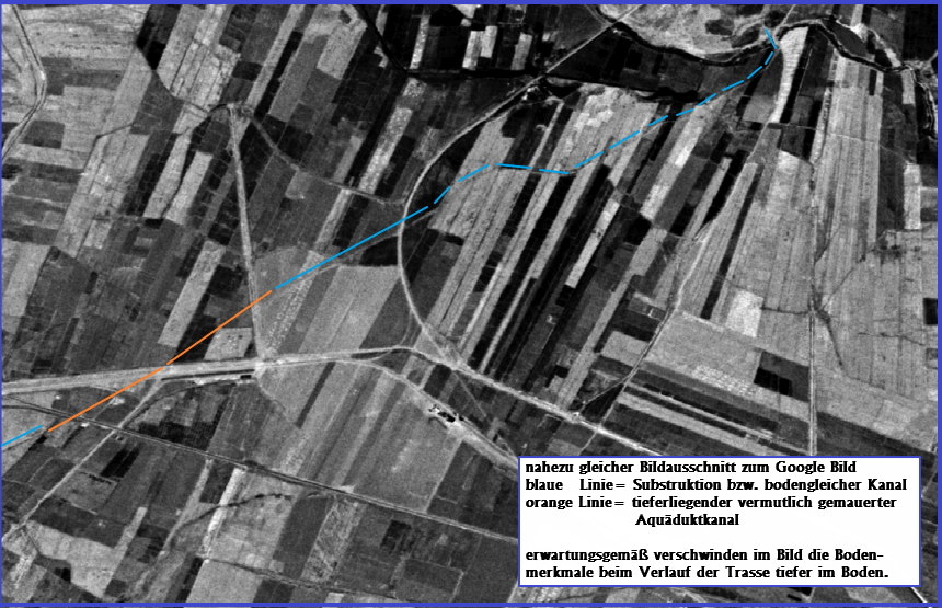
    Large areas of the substructures have completely disappeared in the last 100 years; and also had to give way to agriculture. In the period of 2004-2010 alone, which I was able to compare on the spot, several hundred meters of the old structure were completely removed or pushed together to large cairns by bulldozers. The building on the left picture still used the aqueduct substruction for one of its foundation walls. As can clearly be seen on the current satellite imagery, even all buildings do not exist anymore, presumably because of the civil war. There you can only see blasted and scattered ruins.
    This underlines impressively the current situation around the population and also the ancient cultural treasures in Syria, which make us think very deeply.

    Further south, the Qanat Fir'aun leads…, you will get more information about the following bridge here here.


    Quick Links

    • Qanat Fir'aun
    • the project
    • Surveying
    • important Places
    • Aqueductbridges
    • Substructions
    • other Tunnel Sections
    • previously unknown
    • Copyright

  • Between the reservoir at Dilli and the bridge over Wadi Ezra,

    the aqueduct ran along the contour lines of the terrain. Comparing the remaining fragments from old maps and the NASA's digital elevation data, I was able to find the ruins of a small fort, just beside the aqueduct's clearly visible route. This hitherto-unknown and unexplored structure probably served as protection and as a sampling point. Since it is still an area used for military purposes, further investigations have not been carried out to this day.

    kastell-detail-web

    It turns out that, if possible, the builders of the water pipe preferred straight sections which attached at an obtuse angle to others. The foundation heights of the substructure, which permanently had to be adjusted, were accepted in this case, but required considerably more surveying outlay, in planning and execution.
    The substructures which were built as a two-shell basalt masonry with internal rubble and Opus Cementitium core, the Opus Implectum, are today only rudimentary and are decreasing from year to year.
    Thus, the nearly 2000-year-old construction disappears more and more and can only be recognized in a few areas.

    The Qanat Fir'aun continues southeast to the newly discovered Wadi Ezra aqueduct bridge. For more information about these, please visit: here.

    Here you can see the exact geolocation of this section and ruins.


    Quick Links

    • Qanat Fir'aun
    • the project
    • Surveying
    • important Places
    • Aqueductbridges
    • Substructions
    • other Tunnel Sections
    • previously unknown
    • Copyright

  • and after the bridge over the Wadi edh Dahab,

    the Qanat Fir'aun runs around the lower level north of Dera'a, heading east and then approaching from the north the village of Nueme. Crossing the old Roman road, the main pipe ran towards the Jisr el Mesari bridge. The sub pipe ran parallel to the road towards the "pharaos tower" as a pressure pipe. From there, it ran across the bridge into the valley to the nymphaeum "Hammam Siknany".

    detail-karte-nueime-deraa-web

    Indeed, this described aqueduct route is the actual Qanat Fir’aun which is also proven by the height data. This route is also proven by various travel descriptions with appropriate information. (Freshfield 1869, Baedeker 1875)
    Here again, the distance of 45min from Dera'a is given; even if it is clearly referred to the road to Bosra on which one "met" or passed the Qanat Fir'aun; as well as D.Freshfield spoke about it in recognition of the vast dimensions of the Jisr el Mesari Bridge, or Wetzstein about a "bold bridge". Apparently without any measurement, he estimated the bridge height at 80 feet, which equals 24.3m height. Since the altitude above the Wadi ez Zedi ground is very similar at Wetzstein (40 cubits, expressed at that time, equals 55-60 cm), in summary, a prescription by Wetzstein can be conjectured.
    As it become clear from the context, he has never actually seen remnants of such a bridge in the western direction; and considering the actual height of the aqueduct, as well as the topography of the Zedi valley, a bridge of that height could not have been existed either.
    But maybe only different stories have been accidentally mixed with Wetzstein. The same is true for the first, but also very poetic described at Wetzstein underground refugee cities of the population, with entire squares, market stalls and streets, which, according to G. Schumacher oversize with an average of 12 m² for the squares and 50-60 cm width and 80-120 cm height in reality but quite small exceptions.
    It is clear from the old aerial photographs, the calculated digital altitude models and the entries in the travel descriptions that the Qanat Fir'aun, in its original version, was led around Dera'a in the northeastern direction. It is out of the question that the aqueduct system mentioned by G. Schumacher and approached from the northwest of the village of Otaman directly south to Dera'a, was a third separate system, which can only be temporal arranged after the Qanat Fir'aun. It is possible that this pipe transported the surplus water to the ancient Adraha, after a collapse of the Jisr el Mesari possibly had happened. For details, see "Adraha's pressure line" (Direct to Adraha's pressure line).

    You reach the original main line of the aqueduct and the large bridge Jisr el Mesari over the deep valley of the Wadi ez Zedi here!

    Here you can see the exact geolocation of this construction.


    Quick Links

    • Qanat Fir'aun
    • the project
    • Surveying
    • important Places
    • Aqueductbridges
    • Substructions
    • other Tunnel Sections
    • previously unknown
    • Copyright

  • , led a water channel on grade and along the contour lines, towards Abou el Qantara.

    This part of the aqueduct ran between 443m asl and 437m asl.
    The adjacent picture of the AWM from 1917 shows Australian troops refreshing themselves in a similar Roman aqueduct that was still functional in northern Palestine.
    In addition to a still existing brick channel running from the lake of Muzeirib, there is also another plausible routing, which, however, was recognizable only from old satellite images and could be checked by means of elevation data.

    ausgewertetes Google Sat-bild mit Höhenplan
    gleicher Ausschnitt mit möglichem Trassenverlauf wie blaues Fenster des Google Sat-Bildes

    However, it also shows clearly the basic methods for finding such a route.

    • On the one hand, the strongly tortuous lines of the road between Muzeirib and Abou el Qantara show that the accompanying and masonry canal had existed before the road was built along this route much later. Due to the terrain heights, a newer water channel would have had to be run on the same route; but an already existing road at that time would certainly have run straight between the places, since there were no constraint points in this area.
      Incidentally, the same phenomenon can be found on other aqueduct routes. As an example, the Minturnae (Italy) aqueduct is mentioned, which in some sections also gave later constructed roads their course and direction.
    • On the other hand, the soil depressions and fouling characteristics, especially on old satellite images, are an important indicator of old building structures. If those can be referenced with today's precise elevation models, both the location, in today’s mostly completely changed terrain, can be included in an archaeological survey, as well as the congruence between incised and above-ground running channel and between longitudinal elevation and the maps are checked.

    The Qanat Fir'aun leads to the siphon bridge / pressure line over the Wadi Meddan, at today's Abou el Qantara. Information on this can be found under the following link Wadi Meddan Crossing.


    Quick Links

    • Qanat Fir'aun
    • the project
    • Surveying
    • important Places
    • Aqueductbridges
    • Substructions
    • other Tunnel Sections
    • previously unknown
    • Copyright

  • North of Dera'a