of the Qanat Fir'aun ran over the jisr el mesari.
and what was previously meaningless without knowledge of the place now seems important: G. Schumacher writes "and descends over the basalt cliffs to Jisr el Mesari." That means the incoming altitude was calculated digitally correct, at 534m asl on Ok terrain. The level on the bridge, coincided also with the height data, at S = 526,5m asl. The old builders had no need at this point, as they could not reach both, the oldest part of the city, (el Kerak about 528m asl) as well as the high-altitude Roman district south and south-east of it (about 535m asl). The aqueduct watercourse now circled around the southern Zediufer to reach the city in the southeast.
The maindirection from the jisr el mesari bridge over the "underground city" below the actual city and past El Kerak has the distinct advantage that there are water reservoirs without stagnant water or overflowing water. For example at the nighttime the water has just have to flow away into the valley. Everything is kept flowing and will be resumed when needed. The bridge in the city valley of Dera'a could only, as described in Adraha's pressurepipe sideline, with their pressure pipes only the supply of El Kerak, or Hammam Siknani have served.
The "underground city" described in detail by Wetzstein 1860 (very prosaic) and by G.Schumacher 1886 Across the Jordan (sober / analytical) turns out to be clear, as part of the water management of the Qanat Fir'aun, certainly with individual re-uses. Both the cross sections / longitudinal sections, as well the situation does not suggest otherwise. The walls are plastered ("remains of ancient plaster work ...") and the floor is always inclined in one direction ("slightly downwards ..."). In the description of G. Schumacher, he does not reach the interior beyond the "normal" door "Entrance", but he crawls through a tunnel from which he then falls from a certain height into the so called "vestibule".
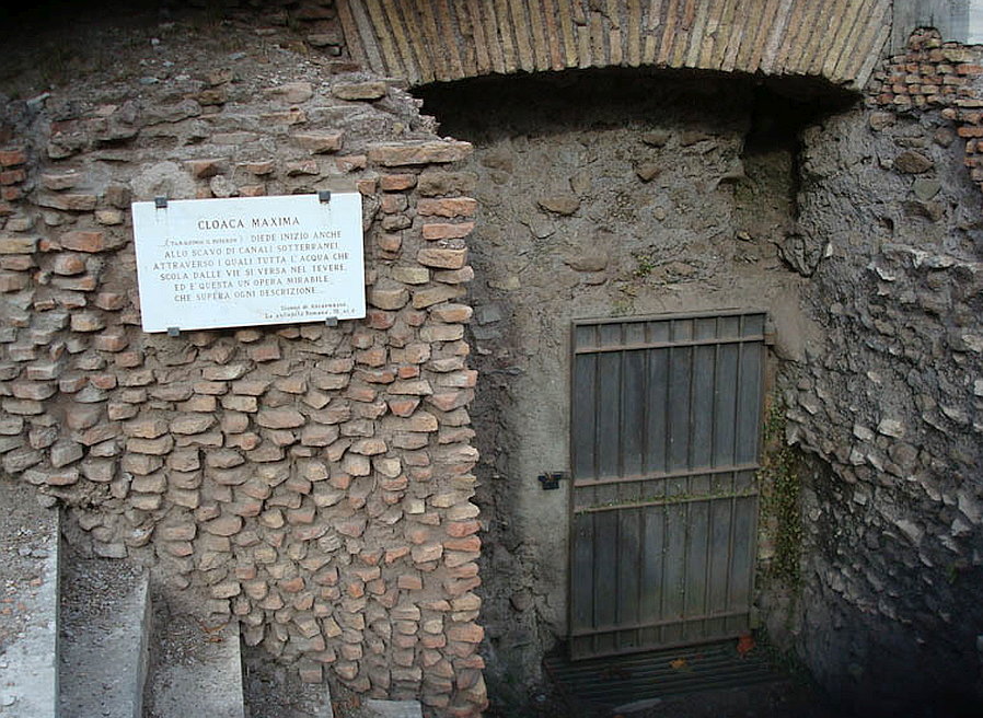 Zugang zum Wasserentsorgungssystem in Rom
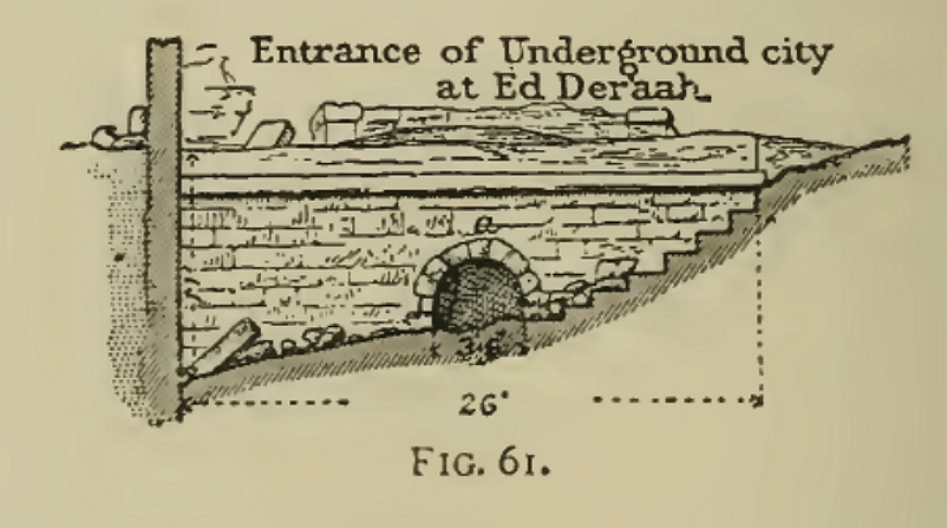 "Entrance" mit Stufen und Stirnwand gemäß Schumacher
The niches referred to in the Description, as shelves "Mangers"mentioned, were at least partially apparently incoming tunnel sections.
The often expressed thesis of the "subterranean escape city" misses on closer inspection of any logic. No high society, let alone the Romans, can seriously believe that they are retreating in really narrow corridors, without various exits in order to escape the dangers of war.
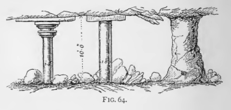
The rectangular "air holes" made with masonry which G.Schumacher found in each of the caverns (These Caverns were hardly more than 10-30m² in size, please remember Wetzsteins descriptions of the same Caverns mentioned as market squares and broad streets and that these have had served as the home of the biblical King Og) are clear and unambiguous well shafts that served the supply of the overlying villae anticae. G. Schumacher proves that as he notes that ruins are always to be found at these "air holes" on the surface and also shows this in section (left).
(Only one episode incidentally: King Og belonged to the giants' sex, he lived according to the Bible in Edrei/Deraa and Ashtarot/Tell Ashtara, according to the Bible alone his bed was 6 cubits (~3m) long, so this has not fitted through the narrow caverns and tunnels; -))))
In the course of the conquests of Adhriat / Adra during the crusades in the 12th century. , but is actually reported by an emergency situation in which the defenders of the city in probably just getting back into this tunnel system.
William of Tire describes this in one of his books, and this supports the suggestion made by me before, explicitly he mentioned the thirsty crusaders, which tried to draw water from the various draw wells of the city Adratum , but always from the defenders in the depths the Ropes were cut through! "so the distress of ours were increased ..."
So we have a proof of a watersupply, which could be entered if necessary, but the original function served only for water supply. From the situation can be concluded that also the water of the eastern outskirts located Ain et Tawileh was fed into the system.
In ancient Athens there was a similar system, but also in Gadara, a tunnel system led in wild branches was found and studied by P.Keilholz among others. Whether it also there were intermediate outlets through the entrances, or possibly wellshafts , is not known.
After analysis of the maps and the comparison with the digital and locally measured heights, the described entrance "Entrance" was at height approx. H = 515m asl. The Aqueduct descends and reaches below the center of the lower city at ground level ~ 535 m a height of 70 feet to the sole (estimate according to G. Schumacher), this would then correspond to S = 511m asl. The caverns / spatial enlargements and their arbitrary dimensions have something to do with the positioning of the well shafts and the overlying structures, etc. The recessed cisterns, if they come from the same time, would make sense as "storable sedimentation basins". Schumacher was not able to explore the routing at that time, but not only the course of the elevation, but also the cross sections of the tunnels (in plan, as dark ovals) and the final direction towards the Kerak point to a part of the aqueduct.
Thus, the line also reaches, but deeper than the area described below, at the large pool of the Hammam Siknany, which could measure about 75,000 m³ at a size of 82mx119m and over 8m depth.
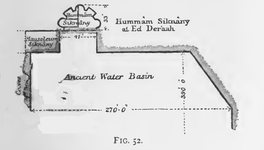
Wetzstein and Schumacher describe the so-called mausoleum Siknany, which is located next to the hammam and with the height of the roof, at the level of the floor of the hammam.
Furthermore, he describes the construction as very massive and at the same time forming the pelvic wall of the large basin in 2 walls of it. The alleged entrance to the "mausoleum", for me an overflow, or expiration is located according to his statements clearly inside and lower in the basin, unfortunately, its height is not specified.
In addition, further cave entrances (shafts !!) are described, which were probably partly buried, and which moved along the top of the terrain. According to the text, these are said to have been connected with the "mausoleum" (Sketch Schumacher, at the side of the mausoleum with the inscription "Caves")
If we start from a bottom height of ~ 511m asl, which was determined last in the "underground city", then we would have to lie below the bottom of the basin (s = 509m).
The alleged mausoleum, in which should be hide "natural and obvious", according to the descriptors, supposedly gold and treasures ;-)) (Wetzstein and Schumacher), is therefore plausible and technically a water tower, in which the aqueduct again the excess water could absorb of the basin.
The lower basin (called "Basin") at the bridge, could have been supplied via a secondary line (height there in the valley 487 m asl). However, this would then speak for a later stage of construction of the above-discussed Castellum 2 and its management on top of the parapet of the viaduct, when the Great about 35m high Jisr el Mesari had already collapsed by earthquakes or the like.
The main aqueduct line pierced in the following el Kerak and flow down to the height of about 503m south of the Slope of the Wadi ez Zedi. Here several more rock-cut and interconnected cisterns could be filled before the aqueduct continued towards Muzeirib / Abou el Qantara and Jordan.
The further course of the Qanat Fir'aun can be found here.
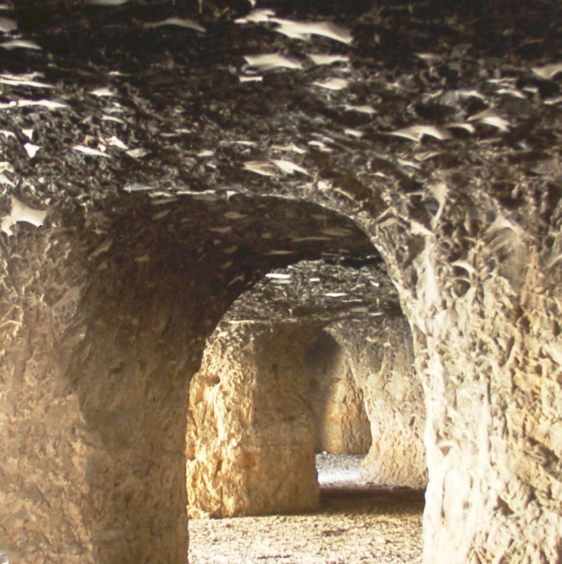
For more information about Dera'a, you can also read Dera'a