The Decapolis city Gadara is surrounded by perennial rivers but cut off from this water resources.
This is caused by the 500 meter difference in altitude. The biggest tributary of the Jordan, the river Yarmuk, lies to Gardara's north, the Jordan to its west and Wadi el 'Arab to its south.
That was the reason why a water supply System has been developed further and enlarged since the early days of the Hellenistic settlement.
At the beginning of the settlement, a water supply system was constructed out of the frequent pouring spring by using a system of cisterns where surface water was accumulated and which was completed by its surrounded springs. Presumably, the water was led into one or more pipes. The beginning of this pipe is, undoubtly, the Ain et Turab.
Within the city's acropolis hill, two different tunnel systems were found, which are named after the altitude of the tunnel, as the "upper" and the "lower" tunnel.
At the aqueduct's inflow, and that in Situ (...), lies the "upper" one which also passes under the "lower" tunnel / water canal.
Regarding the state of construction and assuming a continuously higher position of the upper tunnel, it was generally considered that the unfinished construction had been built after the tunnel was constructed. P Keilholz analyzed C14 findings by Putz from the upper tunnel, which undoubtly indicates a build time before Christ. The documented situation at the beginning of the tunnel (next to the aqueduct bridge) by S. Kerner does not prove any approach about the aqueduct's function. Due to its complexity and regarding those topics and Gadara in general, I refer to the books by S. Kerner/ A. Hoffmann, T. Weber, P. Keilholz and others.
Especially the detailed investigations about the respective drain and the different outlets at the end of the tunnel in the dam wall by P. Keilholz , led to the clarification of the sluice stone and the aqueduct bridge.
By using those surveying data and the determined changes at the sluice stone, I was able to compile a longitudinal section. It was recalculated with the entire hydraulic system by P. Keilholz and thus proved to be true.
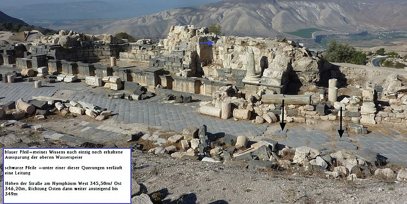
After the analysis of all those data it can be also determined that the nymphaeum at the Decumanus Maximus was filled with two basins (floor height 349,55m and 347,90m asl). The water drained off via three different levels. It is still controversial whether a higher level was planned for the nymphaeum.
 Ansicht des Nymphäum mit Hinweisen
 benetzte Flächen des Nymphäum, Hellblau=größte Höhe, Dunkelblau= niedrigste Höhe auf Niveau der Straße
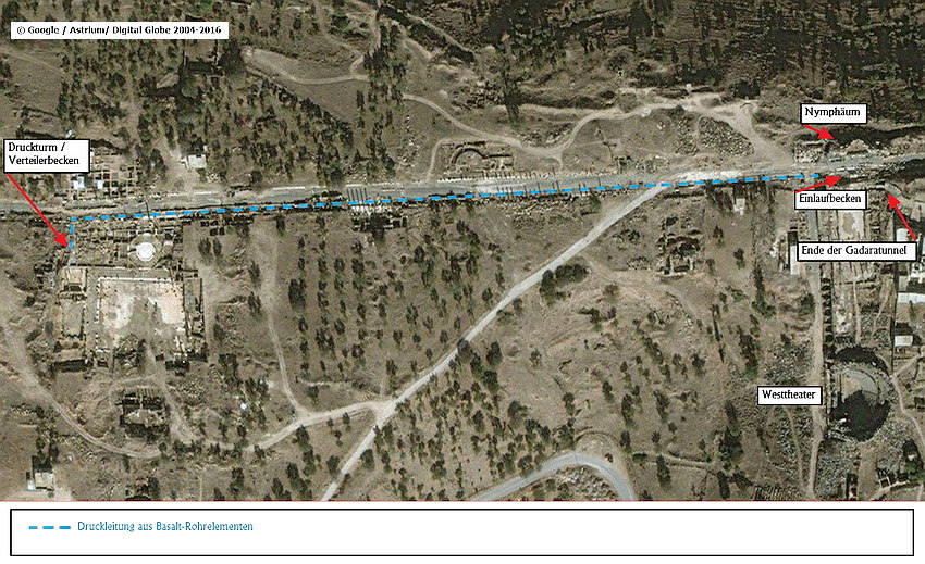
Behind or rather in the dam wall of the lower tunnel, inter alia, the water was distributed to those basins on the nymphaeum. The water was also led into a 500 meters long basaltic penstock which was connected with a basin located opposite the nymphaeum.
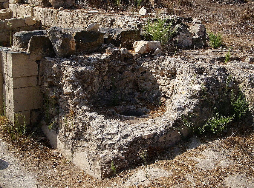
The ruins of the siphon tower, found on October 25 in 2010, are located in a terrain height of 338 m asl and still exist in a height of 1,50 meters. 
Due to the reason that the penstock's suction basin lies in 346,50m asl, and considering the pipe friction, length and height relation, the header tank on the siphon tower is assumed to lie 344m asl.
Whether a further pressure pipe or an open channel sewage towards the Western city border existed, is not known 
To compare the information provided including the bridges which were found in front of the city tunnels, here the Link.
Regarding the two qanats between Ain et Turab and Gadara, I recommend reading the following subpage:Die beiden Qanate im Wadi ain et Turab